Beyond the Familiar Santorini Postcard
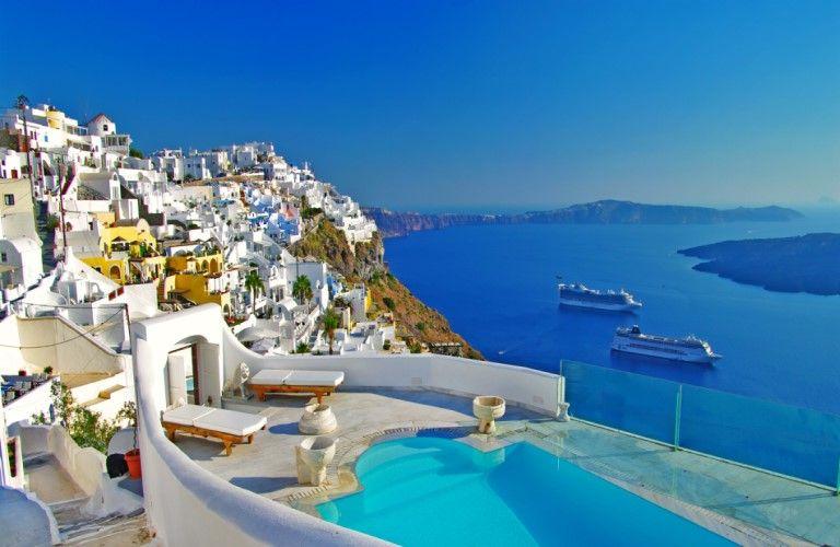
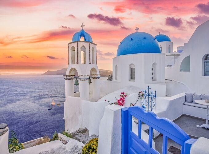
From the water, Santorini's western coastline looks almost impossible. White houses cling to dark volcanic cliffs, church domes rise above tightly packed rooftops, and narrow stairways connect buildings perched hundreds of meters above the sea. It is one of the most recognizable landscapes in Greece, yet the photographs that make it famous reveal surprisingly little about the communities themselves.
Oia, Fira and Imerovigli are often presented as variations of the same picture-perfect village. In reality, each has a different history and character. Oia's elegant houses recall an era of maritime prosperity, Fira developed into the island's administrative and commercial center, and Imerovigli occupies a position once valued for its commanding views across the sea.
The contrast becomes even more apparent inland. Pyrgos, Megalochori and Emporio developed away from the dramatic caldera cliffs, where agricultural life, sheltered courtyards and defensive architecture shaped the settlements. Their winding streets and historic buildings reveal a side of Santorini that rarely appears in the island's most familiar photographs.
Understanding these differences changes the experience of exploring Santorini. Rather than moving between viewpoints that seem increasingly similar, visitors begin to notice how each village reflects a particular relationship with the island's geography and history.
Why Santorini's Geography Shaped Its Villages
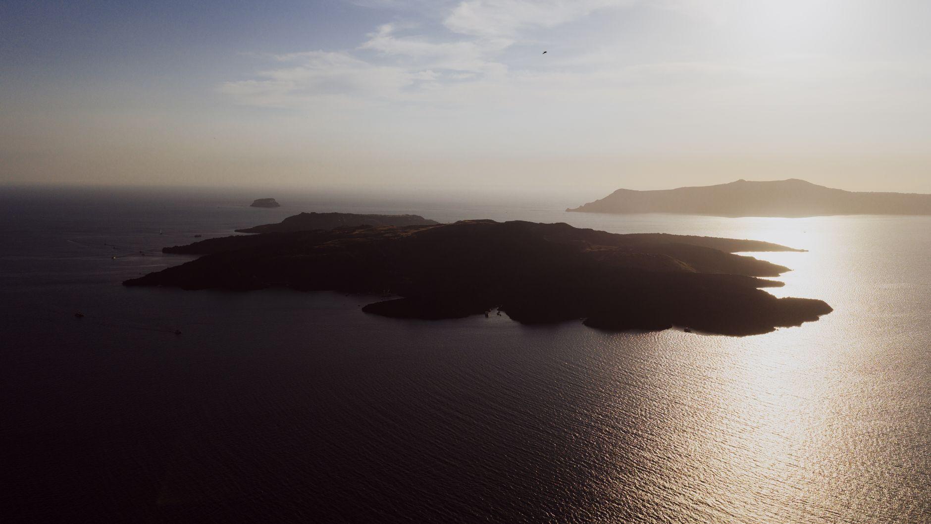
Santorini belongs to the Cyclades island group in the southern Aegean Sea, but its volcanic landscape sets it apart from many neighboring islands. A long history of eruptions, including the enormous Late Bronze Age eruption, helped create the flooded caldera that defines its western coastline.
The island's steep caldera rim offered impressive views and natural defensive advantages, but very little level ground for construction. Builders adapted by arranging houses along narrow terraces, connecting different levels with stairways and excavating rooms directly into the volcanic material.
These traditional cave houses, known locally as yposkafa, are among Santorini's most distinctive architectural features. Partly enclosed by the surrounding earth, they benefit from natural insulation and make practical use of steep terrain.
Inland settlements developed under different conditions. Away from the cliffs, villages could expand around agricultural land, communal spaces and fortified centers. Their architecture often emphasizes enclosed courtyards, narrow passages and closely grouped buildings rather than uninterrupted sea views.
The difference is still visible today, even where historic houses have been carefully restored or adapted for modern use. Santorini's architecture is not simply a decorative style; it is the result of generations responding to the opportunities and limitations of their environment.
Oia: Maritime Heritage Behind the Whitewashed Houses
Oia occupies the northern end of Santorini's caldera rim. Its whitewashed buildings, blue-domed churches and narrow pedestrian lanes have become internationally recognizable, but the village's maritime history provides a more revealing way to understand its architecture.
During the nineteenth and early twentieth centuries, Oia prospered through shipping and maritime trade. Successful captains and shipowners built substantial residences, creating a noticeable contrast with the smaller cave dwellings occupied by other residents.
That distinction remains visible while walking through the village. Some houses are modest structures built into the hillside, while others have larger facades, more elaborate architectural details and a sense of space that reflects the wealth of their former owners.
The Maritime Museum of Oia explores the village's seafaring past, while the remains of the castle of Agios Nikolaos recall an earlier period when coastal settlements needed protection. The castle area is now better known for its sunset views, but its historical role is equally worth remembering.
Below Oia, Ammoudi Bay offers a completely different perspective. Fishing boats and waterfront buildings sit beneath reddish volcanic cliffs, emphasizing the extraordinary height of the village above the sea.
Oia is most rewarding when visitors look beyond its busiest photographic locations. Its quieter streets, historic houses and unexpected architectural details often reveal more about the settlement than any single panoramic viewpoint.
Fira: Santorini's Capital and Cultural Center
Fira, also known as Thira, has a different rhythm from Oia. Although its buildings occupy the same dramatic caldera rim, the town functions as Santorini's administrative and commercial center, giving its streets a livelier and more urban atmosphere.
Shops, restaurants and public buildings occupy a compact network of lanes, while the western edge opens onto sweeping views of the volcanic islands and the sea below. Stairways descend toward lower terraces and the old port, illustrating how the town has adapted to the steep landscape.
The Orthodox Metropolitan Cathedral is one of Fira's prominent landmarks. The nearby Catholic quarter introduces another architectural and religious dimension, reflecting the island's complex cultural history.
Fira is also home to the Museum of Prehistoric Thera, where archaeological discoveries provide insight into life on Santorini before the great Bronze Age eruption. Finds associated with the ancient settlement of Akrotiri help connect the island's volcanic history with the communities that lived here thousands of years ago.
These cultural institutions distinguish Fira from the smaller caldera villages. It is not merely a place to admire the view, but a functioning town where Santorini's historical and contemporary identities meet.
Walking north from the center, the busy commercial streets gradually give way to quieter paths. This transition leads toward Firostefani and Imerovigli, where the caldera remains just as impressive but the atmosphere changes noticeably.
Firostefani and Imerovigli: Villages Above the Caldera
Firostefani begins almost where Fira ends. There is no dramatic boundary between the two settlements, but the difference becomes apparent as shops become less frequent and the walking route passes between residences, chapels and cliffside terraces.
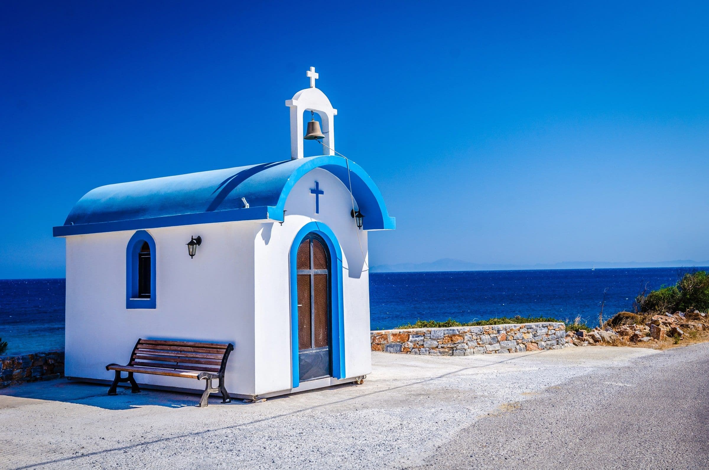
Its name is commonly understood as the "crown of Fira," a reference to its elevated position. One of the area's best-known landmarks is the blue-domed church associated with the Three Bells of Fira, whose setting against the caldera has become a familiar Santorini image.
Farther north, Imerovigli occupies an even more commanding position above the sea. Its elevated location helps explain its historical association with observation and lookout duties, particularly during periods when maritime security was a concern.
The most striking landmark nearby is Skaros Rock, a rocky promontory extending toward the caldera. During the medieval period, it supported a fortified settlement that played an important role in the island's defensive history.
Although little remains of the former buildings, the location itself explains why Skaros was strategically valuable. Its exposed position provided extensive views across the surrounding waters, while the steep terrain offered natural protection.
The path toward Skaros includes steps and uneven sections, so visitors should consider the terrain and conditions before attempting the walk. Even without reaching the farthest point, the setting provides a powerful reminder that Santorini's cliffs once served practical purposes beyond their scenic appeal.
Pyrgos: A Historic Village Away from the Cliffs
Pyrgos stands on a hill in Santorini's interior, away from the continuous line of caldera settlements. Its houses climb toward a medieval fortified center, while narrow streets wind beneath stone arches and between closely arranged buildings.
Unlike Oia's outward-facing terraces, much of Pyrgos feels enclosed. Houses stand close together, passages turn unexpectedly, and small churches appear between residential buildings. This compact layout reflects the village's development around a fortified settlement known as a kasteli.
During periods of insecurity, such arrangements helped provide protection for local communities. The architecture was designed around practical concerns, with buildings forming sheltered spaces rather than opening directly toward panoramic views.
As the streets rise toward the former castle area, the landscape gradually opens. From the upper village, visitors can see vineyards, neighboring settlements and distant coastlines, gaining a broader understanding of Santorini's geography.
Pyrgos is particularly rewarding for travelers interested in traditional architecture. Its appeal lies in the arrangement of ordinary buildings, the character of its streets and the way the village has grown around the hillside.
Megalochori: Courtyards, Bell Towers and Vineyard Traditions
Megalochori offers a quieter introduction to Santorini's traditional village life. Its narrow streets lead past historic houses, distinctive bell towers and enclosed courtyards, while a central square provides a natural gathering place.
The village contains both modest homes and larger residences associated with prosperous local families. High walls and private courtyards create a sense of separation from the street, contrasting with the open terraces and sea-facing buildings of the caldera settlements.
Megalochori is also closely connected to Santorini's agricultural heritage. The surrounding landscape contains vineyards shaped by volcanic soils, limited rainfall and strong winds.
One distinctive local technique involves training grapevines into low basket-shaped formations known as kouloura. This method helps protect grapes from the wind and intense sunlight while keeping the vines close to the ground.
Santorini's Assyrtiko grape is particularly associated with this environment. The vineyards demonstrate how local agriculture developed in response to conditions that might initially seem unsuitable for cultivation.
In Megalochori, traditional houses and agricultural practices tell complementary stories. Both reveal how residents adapted their surroundings to create a sustainable way of life.
Emporio: Inside a Medieval Fortified Settlement
Emporio, in southern Santorini, preserves one of the island's most distinctive historic village centers. Its medieval kasteli consists of tightly grouped buildings connected by narrow passages, covered walkways and unexpected turns.
Unlike a conventional castle standing separately from a village, Emporio's fortified center incorporates residential buildings into its defensive arrangement. The architecture creates a compact environment where streets are sheltered and views are deliberately restricted.
Walking through the old quarter feels noticeably different from exploring the caldera villages. Instead of open terraces and distant sea views, attention shifts toward stone arches, stairways, doorways and small enclosed spaces.
This layout reflects a period when island communities needed protection against maritime threats. The arrangement of the buildings was part of the settlement's defensive strategy.
Emporio is especially interesting for visitors who enjoy discovering places without relying on famous landmarks. Its historic street pattern is the attraction, and the smallest architectural details often provide the strongest impression.
What Santorini's Architecture Reveals About Its History
Across Santorini, whitewashed walls, vaulted roofs and compact buildings create a recognizable Cycladic character. Yet these similarities can obscure the differences between individual settlements.
Oia's captains' houses reflect maritime prosperity. Fira's public buildings reveal its role as the island's capital. Imerovigli and Skaros illustrate the importance of elevated defensive positions, while Pyrgos and Emporio preserve the enclosed layouts of fortified communities.
Megalochori provides another perspective through its courtyards, historic residences and connections with agricultural traditions.
Even the familiar white buildings tell a more complex story when examined closely. Traditional Santorini architecture also incorporates volcanic stone, earth tones, colored plaster and construction methods adapted to different locations.
The island's villages are therefore not interchangeable examples of picturesque Greek architecture. Each preserves evidence of the people who lived there, the work they performed and the challenges they faced.
Discovering Santorini Beyond a Single View
Santorini's caldera deserves its reputation, but the island becomes more interesting when its villages are approached as distinct communities rather than a collection of scenic viewpoints.
The maritime houses of Oia, the urban streets of Fira, the former lookout at Skaros and the fortified passages of Emporio all belong to the same island, yet each reflects a different historical need.
Moving between the caldera rim and the interior reveals a place shaped by trade, agriculture, religious traditions and centuries of adaptation to an unusual landscape.
Sometimes the most memorable discovery is not another panoramic terrace, but a quiet street where Santorini's history remains visible in the arrangement of its buildings.
Frequently asked questions
Oia, Fira, Firostefani and Imerovigli overlook the caldera. Their elevated positions provide different perspectives of the volcanic cliffs, surrounding sea and nearby islands.
Oia is known for its maritime heritage and historic cliffside houses. Fira is Santorini's capital, combining caldera scenery with museums, shops and public services.
Pyrgos, Megalochori and Emporio offer historic lanes, churches and traditional houses. Their architecture reveals the island's agricultural heritage and medieval fortified settlement patterns.
Skaros once supported a medieval fortified settlement. Its elevated position above the caldera made it strategically valuable for observing maritime activity and defending the area.
Traditional cave houses use excavated volcanic material to create sheltered interiors. Their construction provides natural insulation and makes efficient use of steep hillsides.