Map of Turkey: A Complete Guide to Regions, Cities, and Geography
Understanding the map of Turkey is the first step to planning a memorable Turkey journey through this diverse and fascinating country. Positioned at the crossroads of Europe and Asia, Turkey connects continents, cultures, and civilizations. Its strategic location, varied landscapes, and rich history make it one of the most intriguing countries to explore.
From coastal resorts and ancient cities to mountain ranges and modern metropolises, Turkey’s geography shapes its culture, climate, and travel experiences.
Where Is Turkey Located?
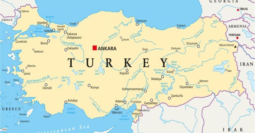
Turkey is located in both Southeastern Europe and Western Asia. About 97% of its landmass lies in Asia (Anatolia), while the remaining 3% is in Europe (Eastern Thrace).
It is bordered by eight countries: Greece and Bulgaria to the northwest; Georgia to the northeast; Armenia, Azerbaijan (Nakhchivan), and Iran to the east; and Iraq and Syria to the south.
Turkey is also surrounded by three seas:
- The Black Sea to the north
- The Aegean Sea to the west
- The Mediterranean Sea to the south
The Bosphorus and Dardanelles straits divide the European and Asian sides of the country.
Turkey’s Seven Geographical Regions
Turkey is divided into seven main geographical regions, each with its own climate, landscape, and cultural identity.
Marmara Region
The Marmara Region is home to Istanbul, Turkey’s largest city and economic hub. This region bridges Europe and Asia and features fertile plains, coastal areas, and major ports.
Important cities include Istanbul, Bursa, Edirne, and Tekirdağ. The region has a mild climate and plays a crucial role in trade and tourism.
Aegean Region
Located in western Turkey, the Aegean Region is known for its beautiful coastline, olive groves, and ancient ruins.
Cities such as Izmir, Ephesus (near Selçuk), Bodrum, and Çeşme attract visitors for their beaches and archaeological sites. The climate is typically Mediterranean, with hot summers and mild winters.
Mediterranean Region
Stretching along the southern coast, the Mediterranean Region is famous for its turquoise waters, luxury resorts, and dramatic mountains.
Antalya, Alanya, and Fethiye are major tourist centers. The Taurus Mountains rise sharply behind the coast, creating stunning scenery and diverse ecosystems.
Central Anatolia Region
Central Anatolia forms the heart of Turkey and includes the capital city, Ankara. This region features wide plains, steppe landscapes, and volcanic formations such as those in Cappadocia. Cities include Konya, Kayseri, and Eskisehir.
Winters can be cold, while summers are dry and warm.
Black Sea Region
The Black Sea Region is lush, green, and mountainous, with frequent rainfall and dense forests.
Cities like Trabzon, Rize, and Samsun are known for tea plantations, traditional wooden houses, and dramatic coastal cliffs.
This region has a distinct culture and cuisine compared to the rest of Turkey.
Eastern Anatolia Region
Eastern Anatolia is the highest and coldest region in Turkey. It is home to Mount Ararat, the country’s tallest peak.
Cities such as Erzurum, Van, and Kars offer insight into ancient civilizations and rugged natural beauty. Winters are long and snowy, making this region popular for skiing.
Southeastern Anatolia Region
This region borders Syria and Iraq and is culturally rich with strong Middle Eastern influences.
Cities like Gaziantep, Sanlıurfa, and Mardin are famous for historical sites, traditional architecture, and world-renowned cuisine.
The climate is hot in summer and mild in winter.
Major Cities on the Map of Turkey
Understanding Turkey’s major cities helps travelers plan efficient routes:
- Istanbul – Cultural and economic center
- Ankara – Capital city
- Izmir – Aegean coast metropolis
- Antalya – Mediterranean tourism hub
- Bursa – Historical Ottoman capital
- Adana – Southern industrial city
- Trabzon – Black Sea coastal city
- Gaziantep – Culinary capital
How the Map of Turkey Helps Travelers
Using a map allows travelers to:
- Plan travel Turkey routes efficiently
- Understand regional climates
- Combine destinations logically
- Estimate travel times between cities
- Discover lesser-known regions
Whether traveling by car, bus, train, or plane, geographic awareness improves the overall travel experience.

Turkey’s Strategic Importance on the World Map
Turkey controls access between the Black Sea and the Mediterranean through the Bosphorus and Dardanelles straits, making it geopolitically significant.
Historically, it served as a bridge for trade routes such as the Silk Road and continues to play a key role in global commerce and diplomacy.
Final Thoughts
The map of Turkey reveals a country of remarkable contrasts and harmony—where continents meet, seas surround diverse landscapes, and cultures blend across regions.
Understanding Turkey’s geography helps travelers appreciate its history, climate, cuisine, and travel possibilities. Whether you explore ancient ruins on the Aegean coast, hike in the Black Sea mountains, or relax on Turkey Mediterranean beaches, the map of Turkey is your gateway to endless discovery.
Frequently Asked Questions (FAQs)
- Is Turkey in Europe or Asia?
Turkey is in both Europe and Asia, with Istanbul spanning both continents.
- How many regions does Turkey have?
Turkey has seven official geographical regions.
- What seas surround Turkey?
Turkey is surrounded by the Black Sea, Aegean Sea, and Mediterranean Sea.
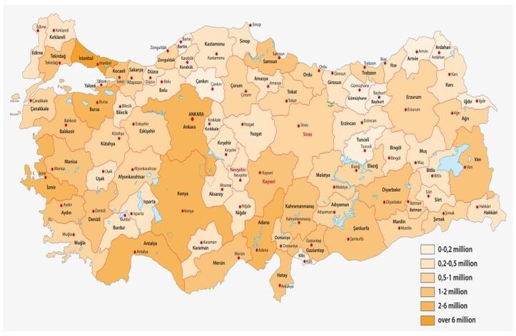
- What is the largest city in Turkey?
Istanbul is the largest city by population.
- Why is Turkey geographically important?
Turkey connects Europe and Asia and controls vital sea routes between the Black Sea and Mediterranean.

